The Island at the edge of the world (and it’s sheep)
Four days ago, I rode in a helicopter (my first time) to journey to the remote Scottish islands of St. Kilda to help with the Soay Sheep Project. St. Kilda is a group of islands located over 60 kilometres away from the ‘Outer Hebriedes,’ which is an island chain off the western part of the Highlands. Of course, this journey from the Outer Hebriedes was made via boat for centuries. Rough waters have, at the best of times caused voyagers to be seasick, and at the worst, have sunk ships. In a secondhand bookshop in Edinburgh, I discovered a gem titled “St. Kilda: A Voyage to the Edge of the World” by W. R. Mitchell, in which the author recounts a journey made by a crew rowing to St. Kilda in 1697. “Our crew became extremely fatigued and discouraged without the sight of land for sixteen hours”. In contrast, I sat comfortably in my safety suit, fashioned with an inflatable life jacket, for the ~25-minute duration of my flight. I was astonished by the vastness of the open ocean below me, nothing but water in sight.
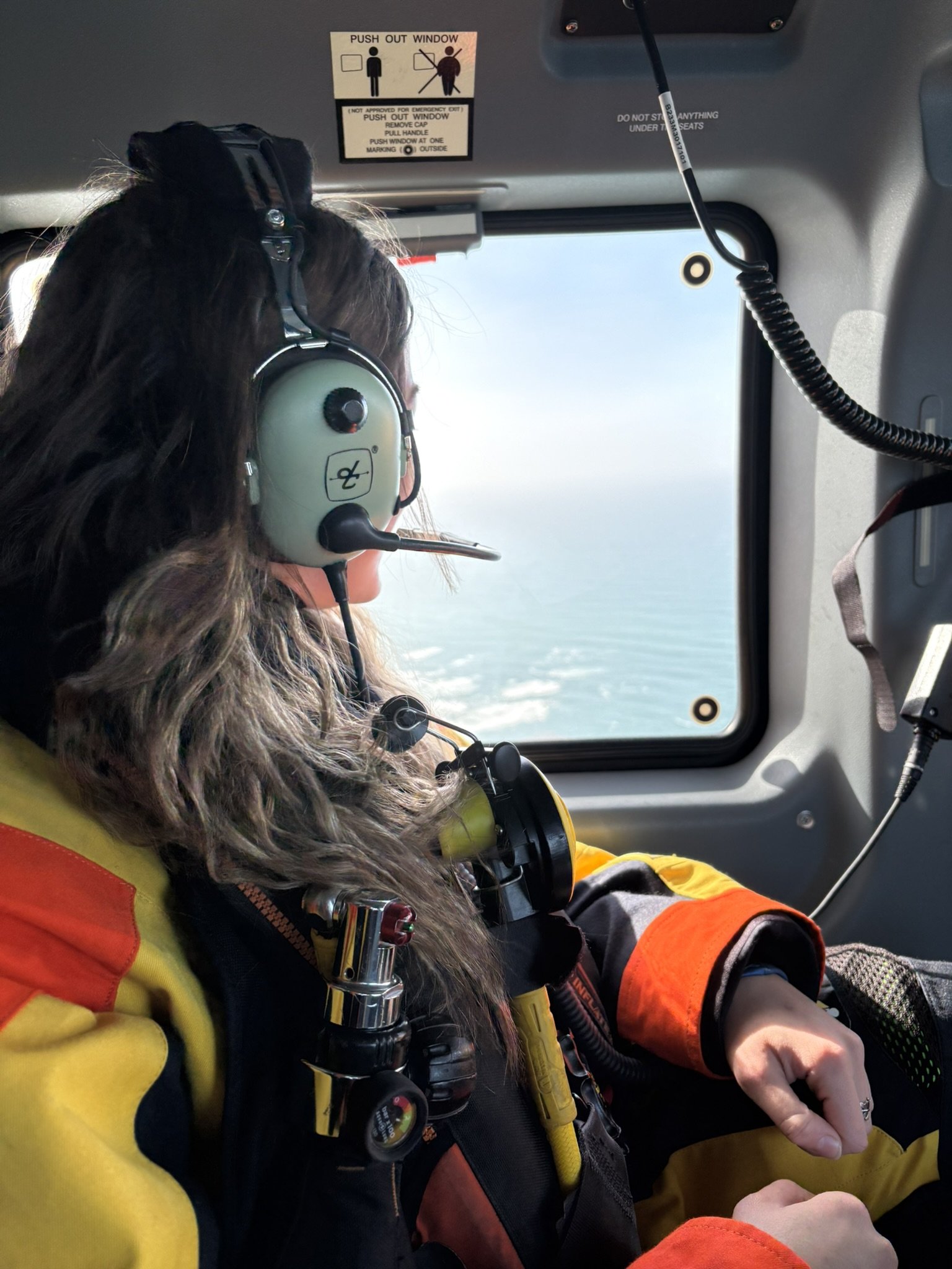
We were lucky to be travelling on such a lovely day. As the island came into view, its colours were saturated by the sun. The dramatic peaks contrasted with the plain blue sky and water surrounding them. The only thought I could conjure was how unreal the whole thing looked. We drew so close that the peak of Oiseval, on the eastern side of the island, filled the entire window to my right. I had a birds-eye-view of the dark cliffs and crashing waves as we descended to the helipad.
I feel like a fictional character in Lord of the Rings or Harry Potter. It’s late-March, the beginning of the spring season here, and the main goal for the Soay Sheep Project is to census the entire study population before lambing begins, to understand which individuals survived the winter. So for the three days following my arrival, I’ve set out on an adventure with a telescope over my shoulder and binoculars around my neck, climbing up these magnificent rounded peaks, carpeted with soft greens and dark heather. We use the scope and binos to look for coloured ear tags that identify individual sheep. We’re armed with a phone app that allows us to immediately identify the individual and its location.
The first day, Erin, a postdoc who has been here for the past two seasons, showed myself and Eva, a PhD student, how to systematically search for sheep on the east side of the island, which we call ‘Route 1’ and the west side of the island, ‘Route 2’. In theory its quite easy work; you go on a walk and look for sheep. But obviously, as with any fieldwork, it’s not as simple in practice. The elements, terrain, and animals can, and often do, make things quite complicated.
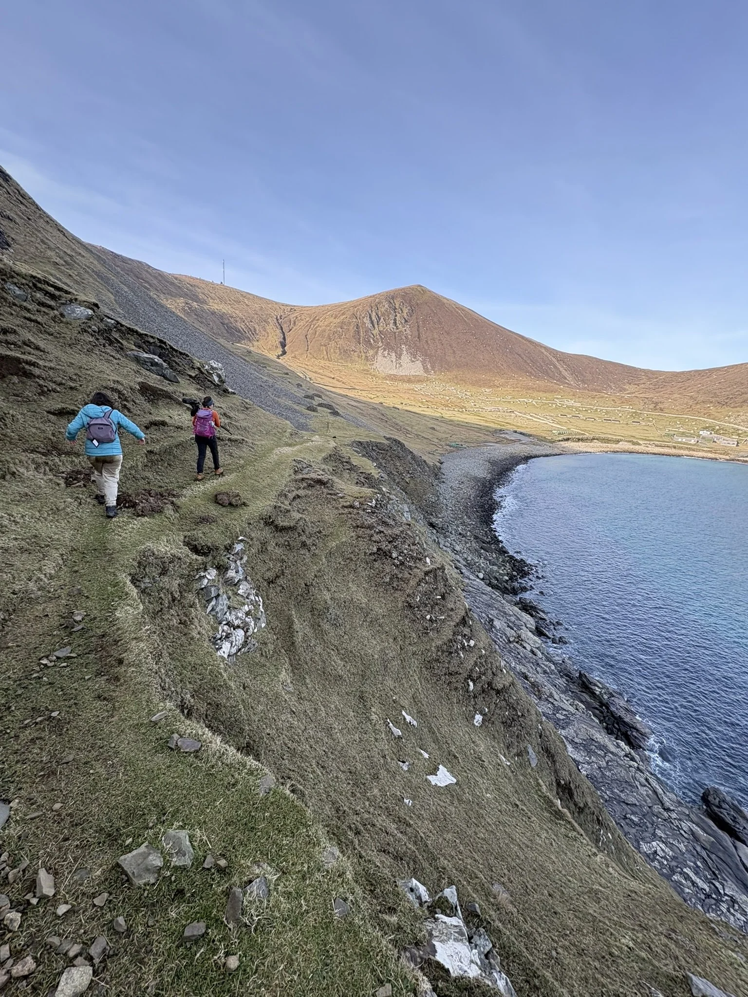
For example, after doing Routes 1 and 2 back to back on our very first day (typically, one person would be responsible for covering one route in a day), we had finally reached the end of the census, a large peak on the west end of the island called Ruival, when Erin noticed some sheep at the very top of the hill. Our calves were burning as we perched on the near vertical slant, necks cranked up, squinting at the silouette of several sheep. I would consider myself a decently fit hiker, but navigating up these hills and then balancing a telescope and yourself is not easy.
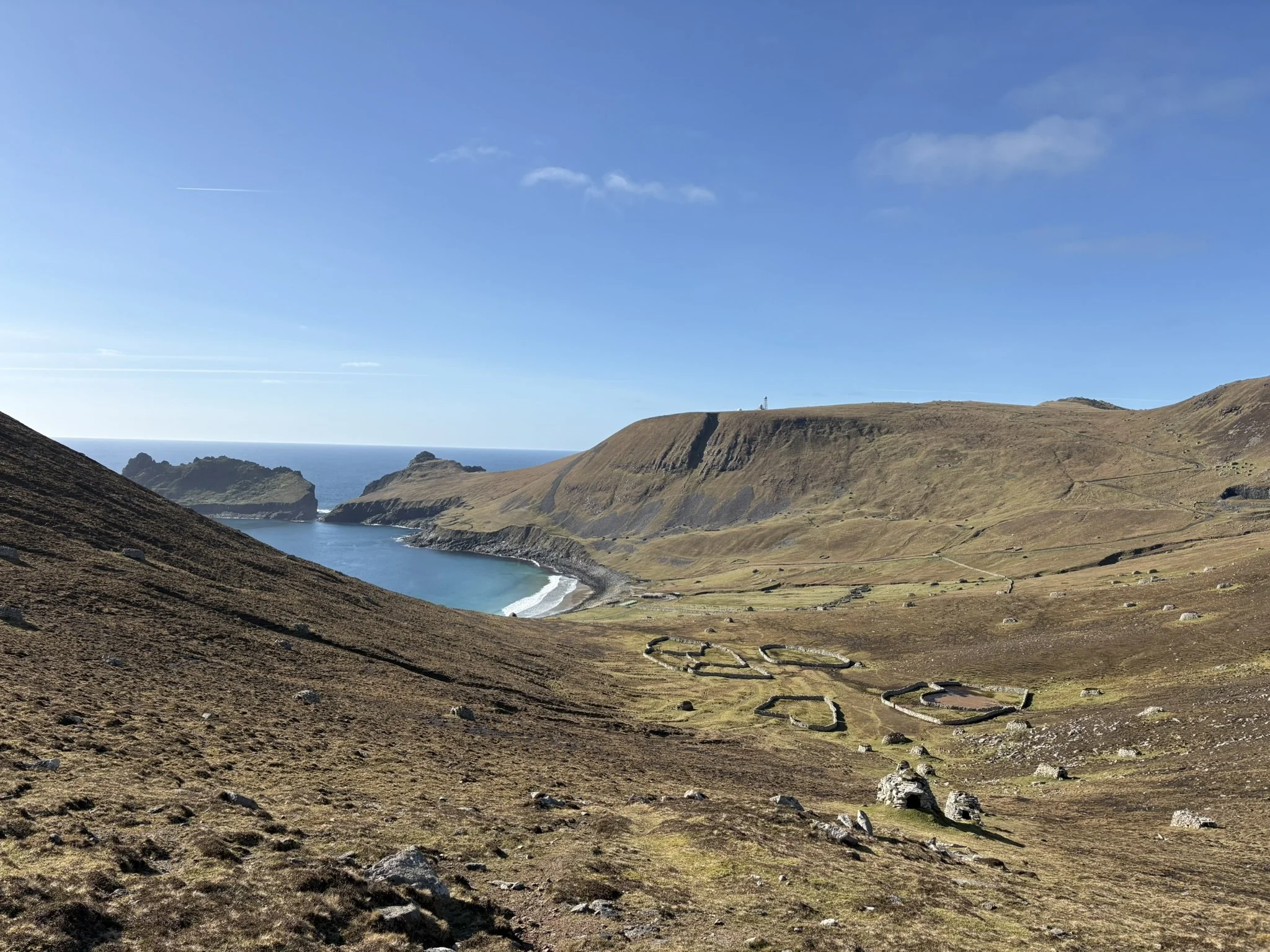
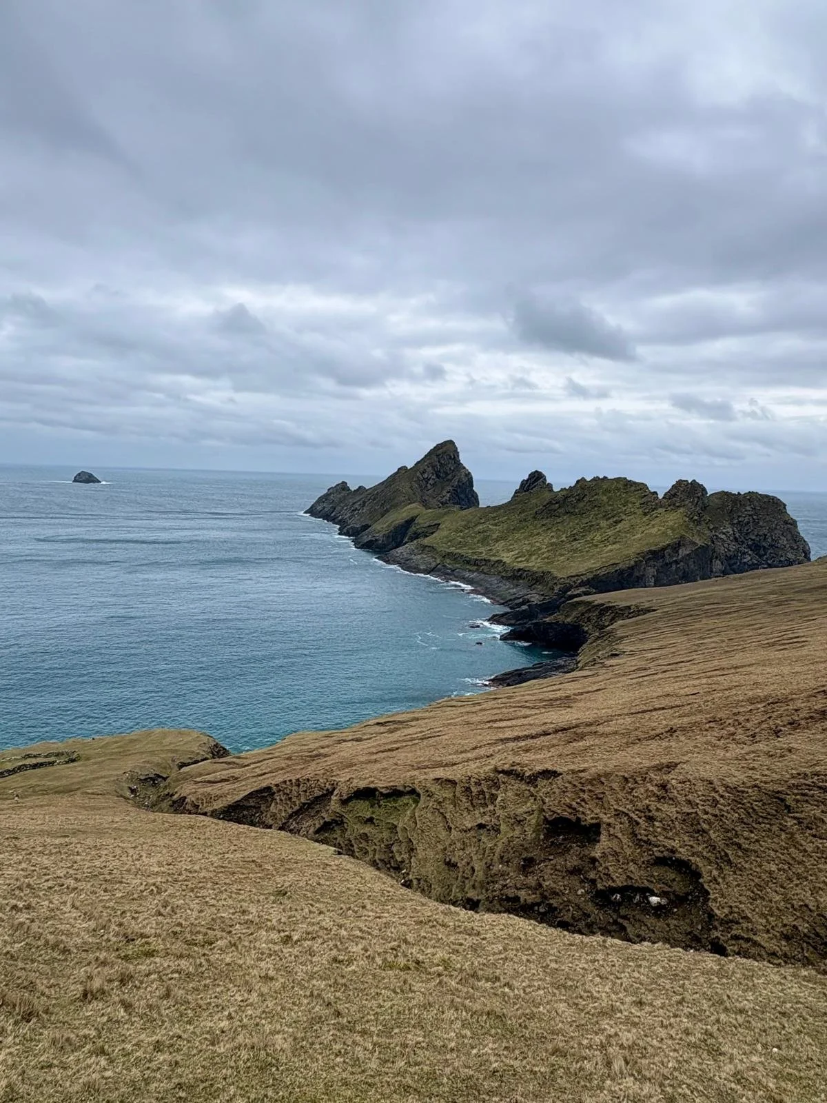
An example of the steep slopes: the view from Oiseval
On my second day, I set out to census the sheep in Route 1 on my own. Everything was going quite well until the wind came. I found myself in the valley between the peaks of Oiseval and Conachair, a seemingly perfect wind tunnel. I had been trying to read the tag on a tup (a male sheep) I’d been following, when he turned to face me. “This is the moment I’ve been waiting for,” I thought to myself excitedly. I zoomed in as far as possible on the telescope and began focusing it with shaky hands, when the wind nearly ripped the scope from me. I steadied it again, finding the tup. But then the tears began. You know the tears that you can’t help but shed in cold winds? It was a battle to blink my tears away quickly enough to read the tag and keep the scope upright, let alone focused on a tag. We’ve been lucky so far with having relatively clear conditions and only some wind, but it seems to be that as soon as you say out loud how nice the weather is in Scotland, Scotland changes her mind.
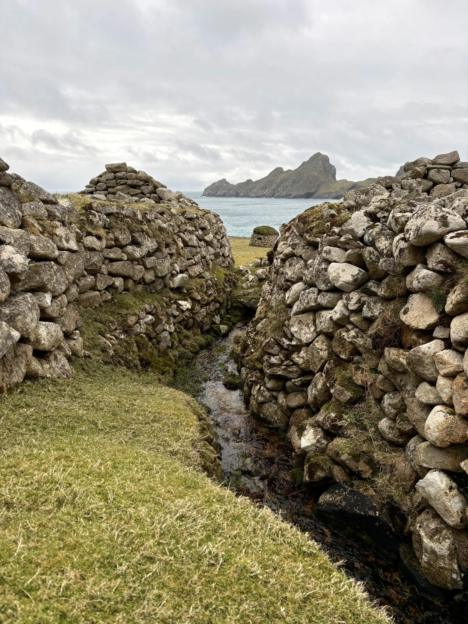
View of Dùn from Hirta
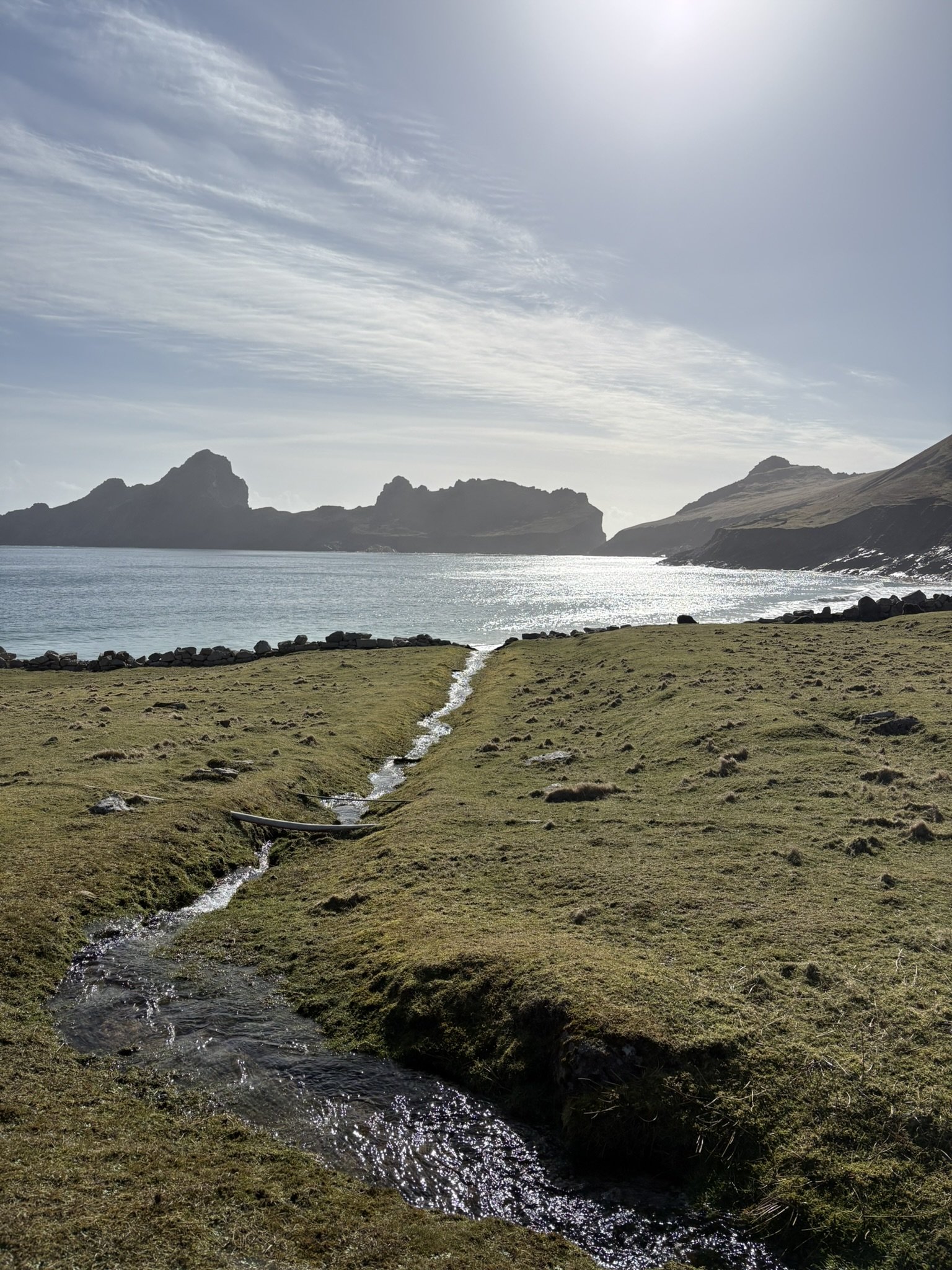
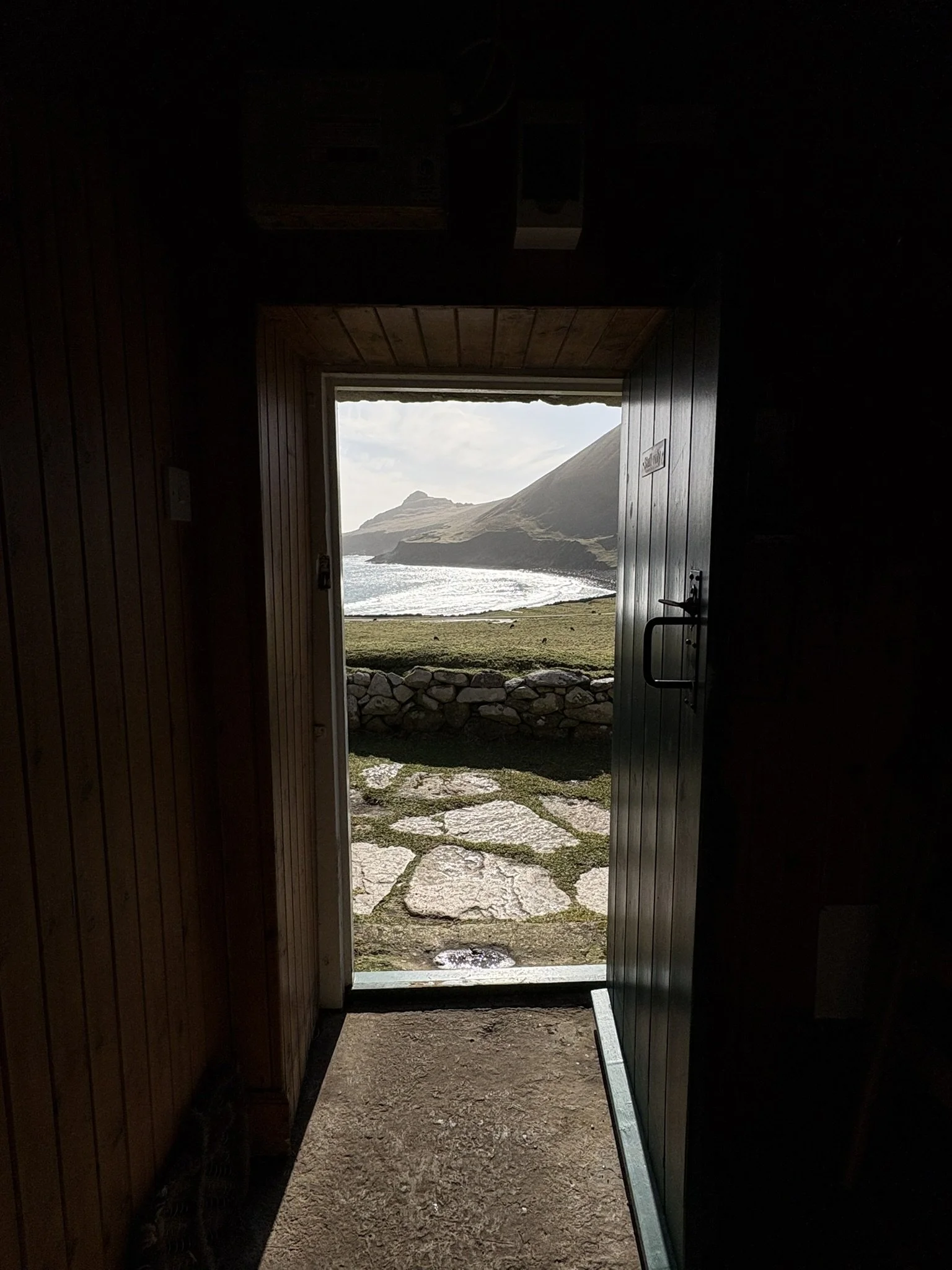
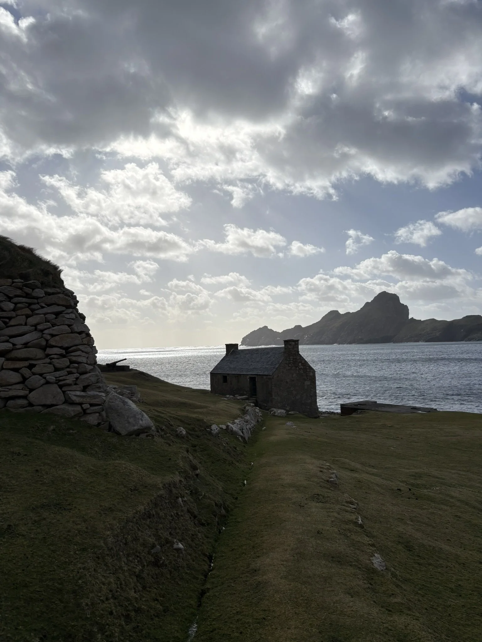
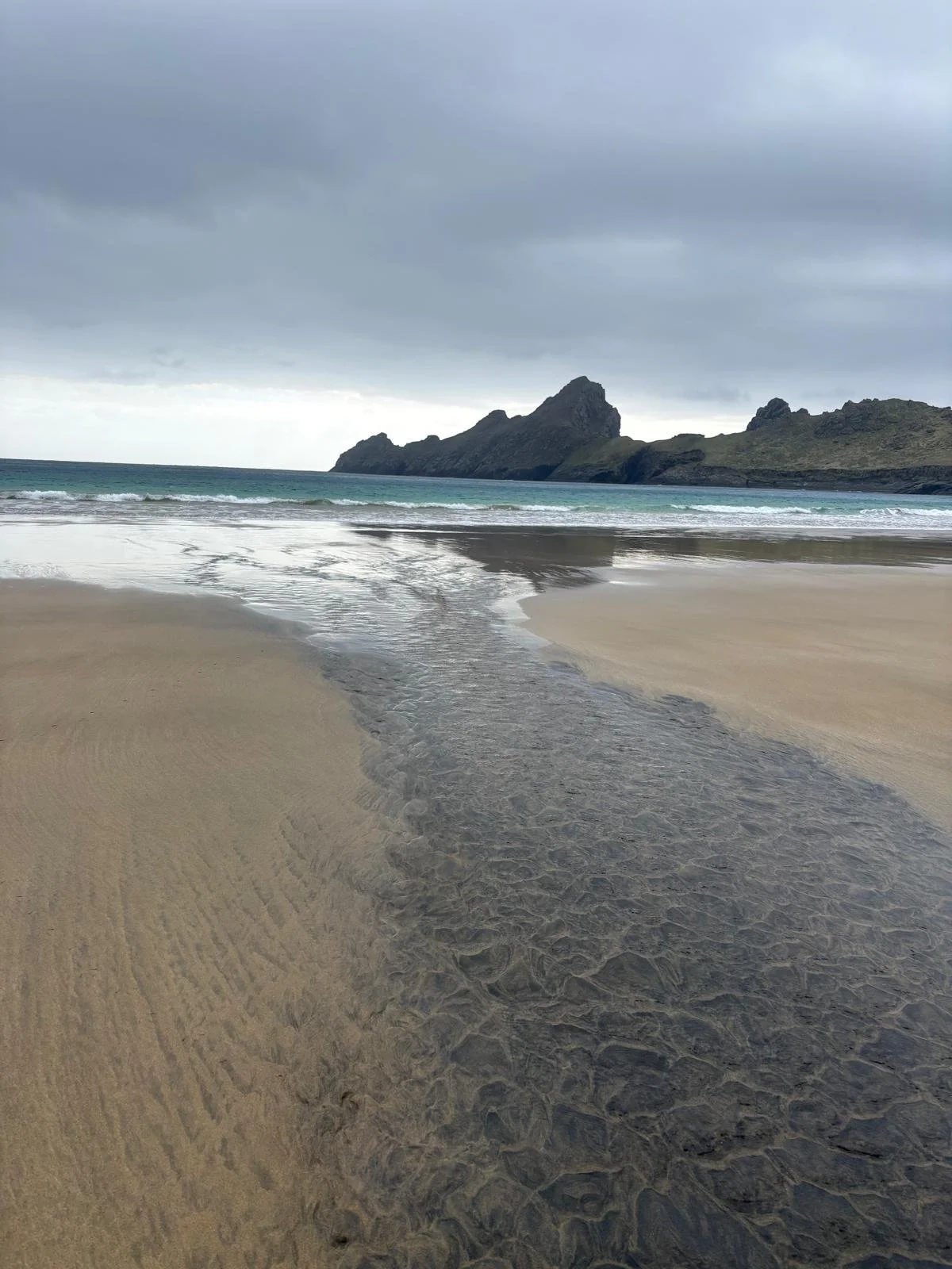
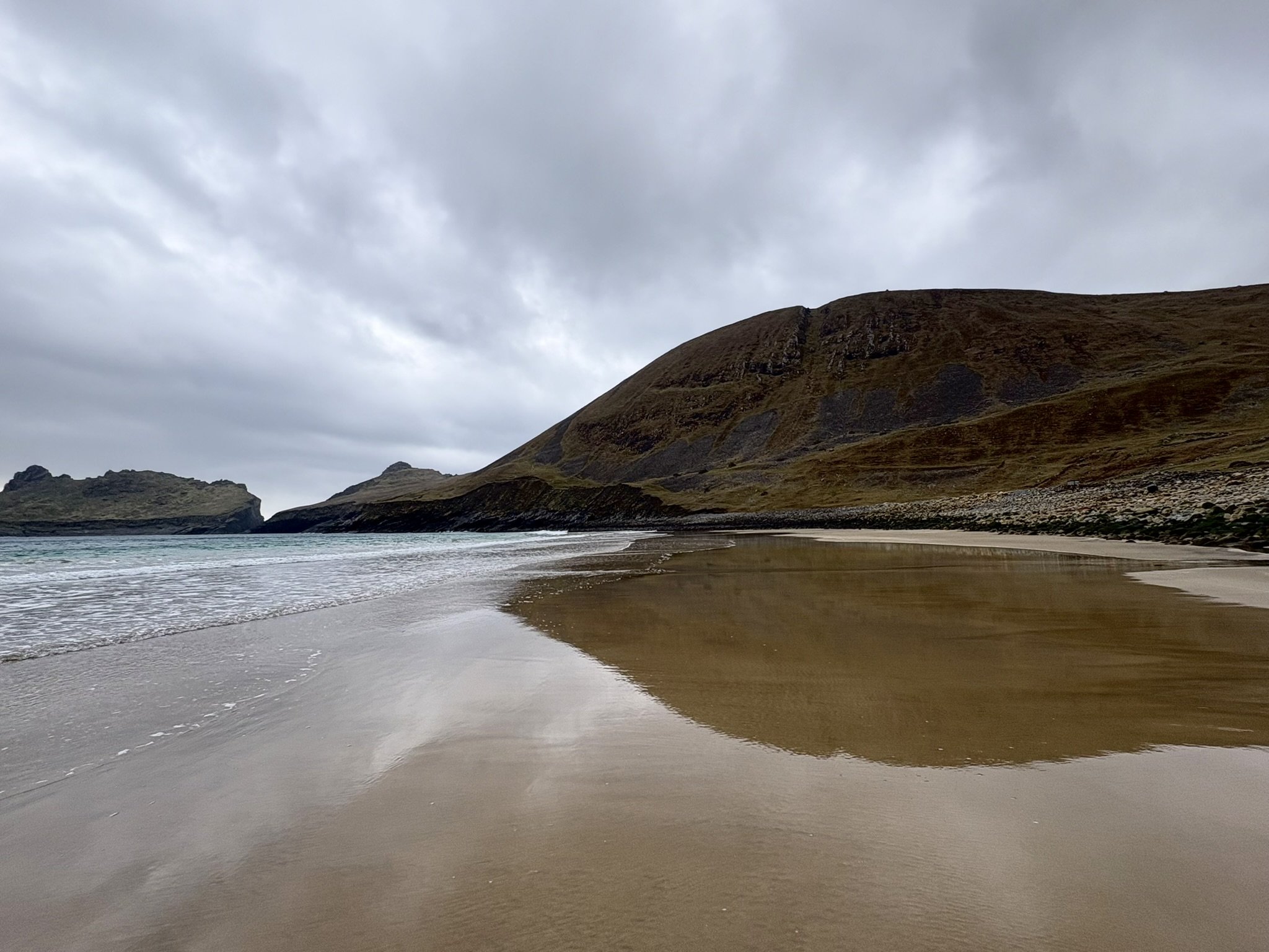
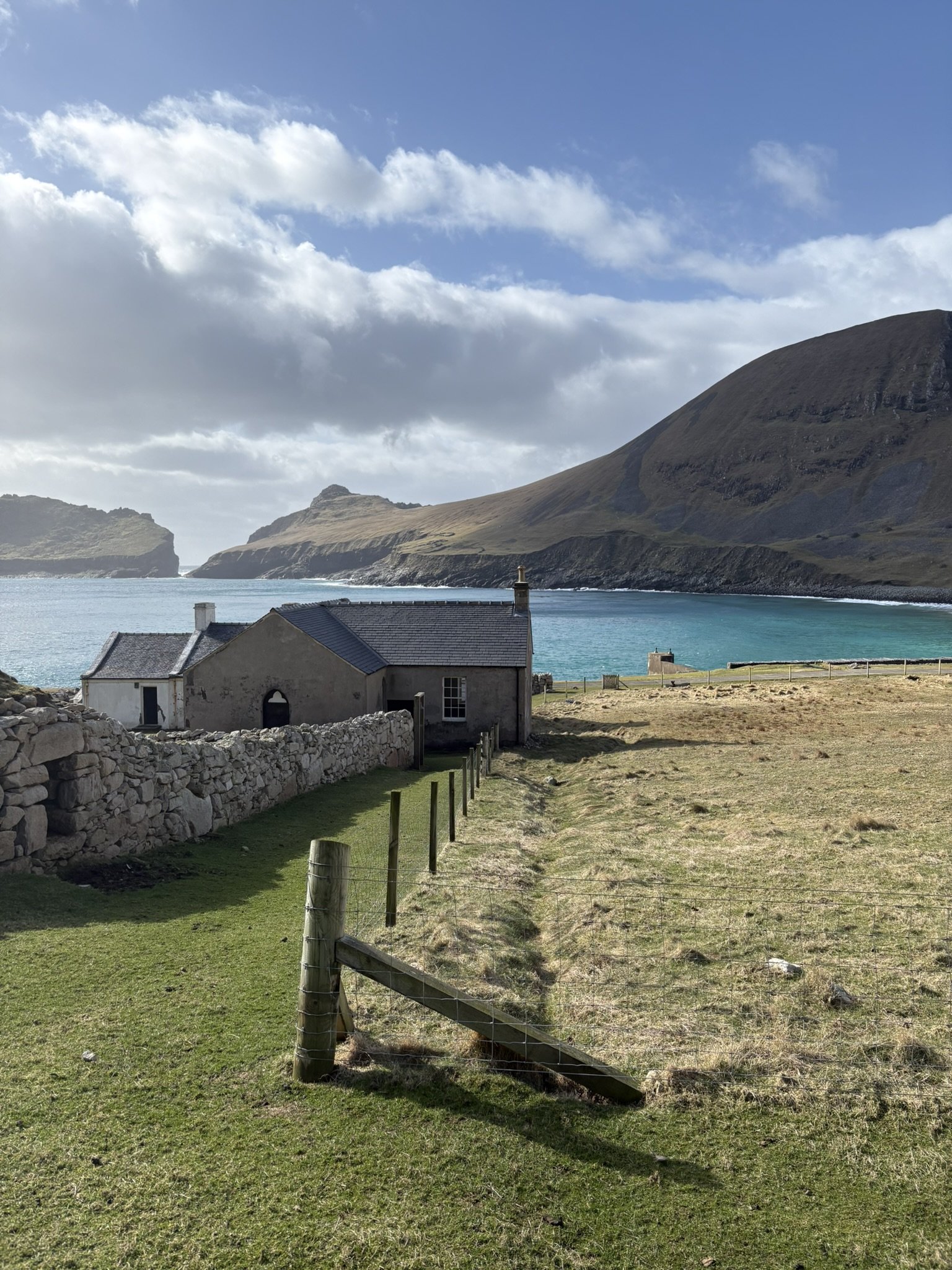
My neck is stiff from looking through the scope for prolonged periods, willing sheep to look up from the patch they’re grazing or to come out from behind the rock blocking my view. My clothes are muddy from a few missteps. And my face always feels a little windburnt. But I’ve never experienced a more unique and beautiful place. Within St. Kilda, we’re on the island of Hirta. Unlike the surrounding islands, it has a large, rounded sandy bay, where oystercatchers chase one another along the shore. There are numerous large peaks, some of which are divided by a cascading stream that trickles out to the ocean. From Hirta, we can see Dùn (pronounced Dune), with its incredible, dark sea cliffs, where thousands of seabirds nest. There is a constant supply of fulmars flying between Dùn and Hirta. I’m looking forward to the arrival of puffins.
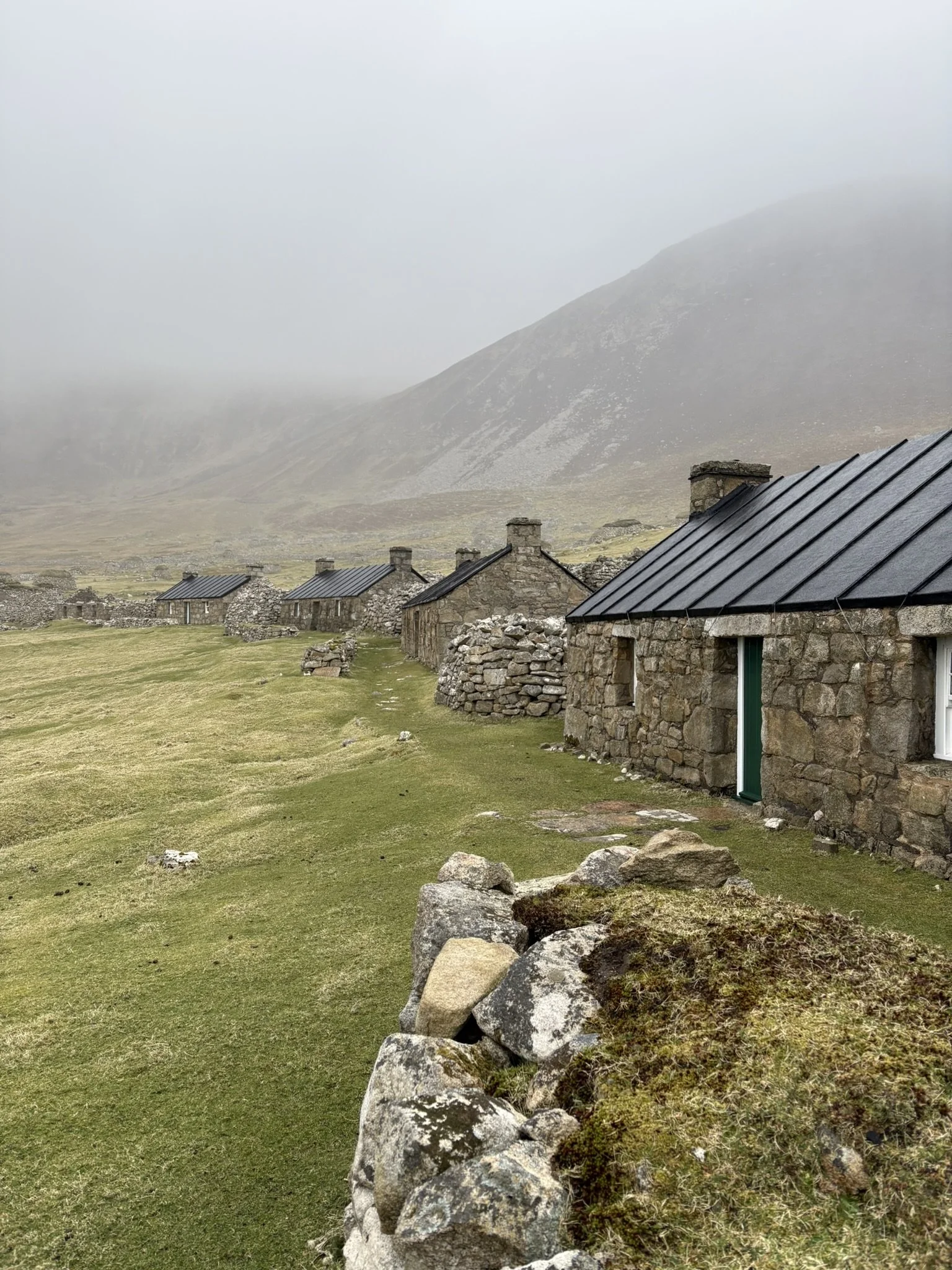
Wondering what it’s like to live here? I’m only halfway through my aforementioned book, and there is so much history to learn, so forgive me for being vague for now. Records of human life on St. Kilda date back to the Middle Ages. Different communities have populated and been wiped off the island over time. The names given to places here are a mix of Gaelic and Norse, I believe (the latter pointing to a prolonged presence of Vikings). In the 1700s, the population reached over 100 people, but at the same time, boats carrying diseases led to the death of many residents. St. Kildans ‘fowled’ (hunted) for nesting seabirds along cliffs- a dangerous profession. They also kept livestock and seemed to be quite self-sustaining historically, particularly in winter when no ships were able to access the island. In the late 19th and 20th centuries, it seems the island was relatively well connected to the mainland. Some teachers, nurses, and priests were stationed here. Brave captains served as mailmen and delivered goods to the residents. By 1930, the population had fallen to 35, and the islanders were evacuated to the mainland for a ‘better life’. Their little world was left behind. Eventually, the National Trust of Scotland (NTS), a non-profit, purchased the island. They have done an incredible job preserving the place. Six of the 16 stone cottages have been restored and are now accommodation for NTS volunteers and other visitors, including me!
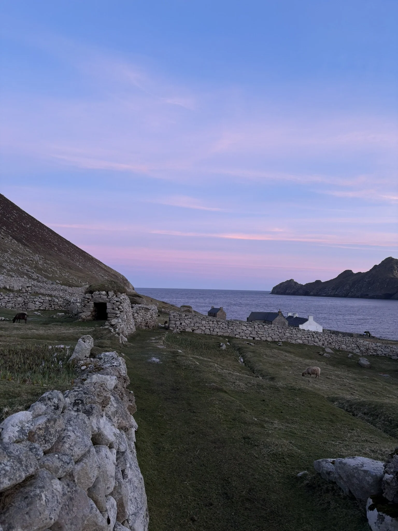
The street
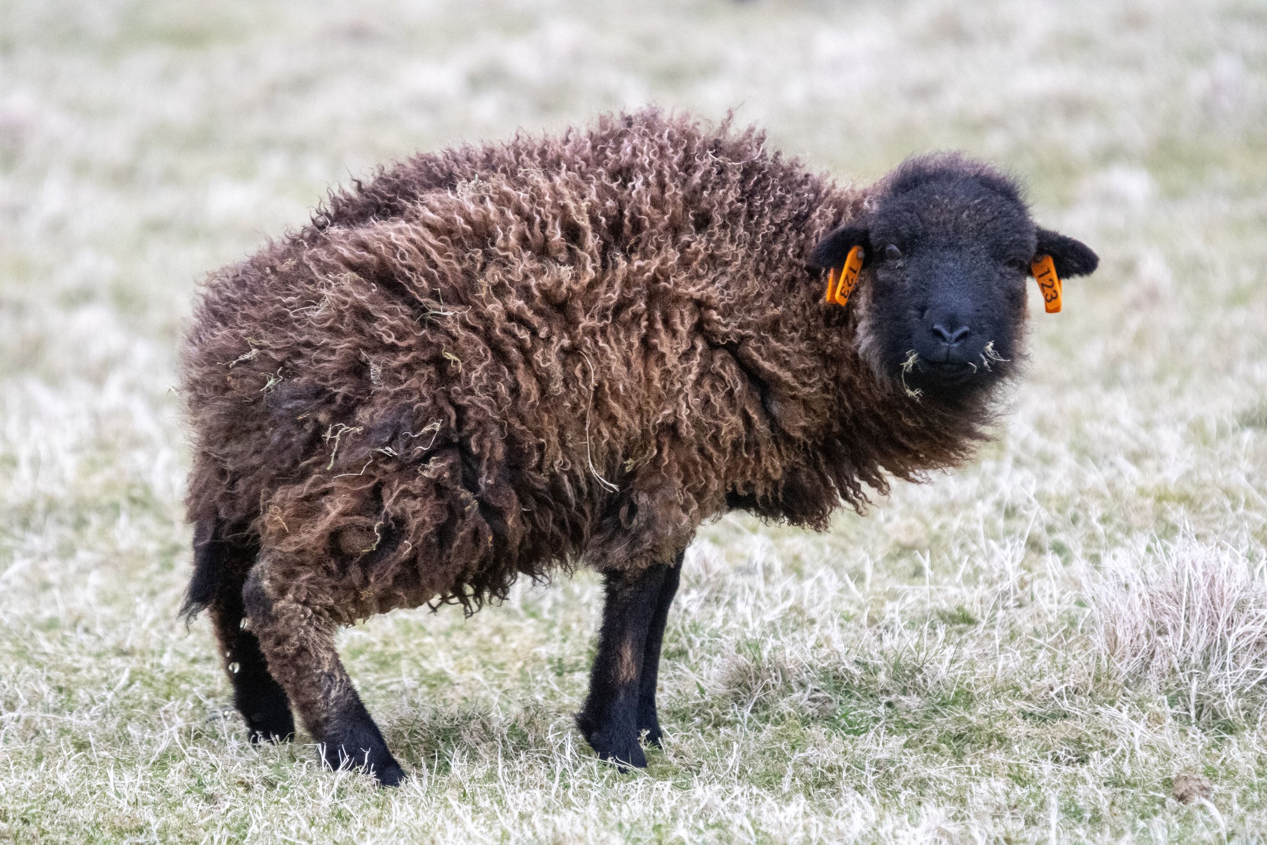
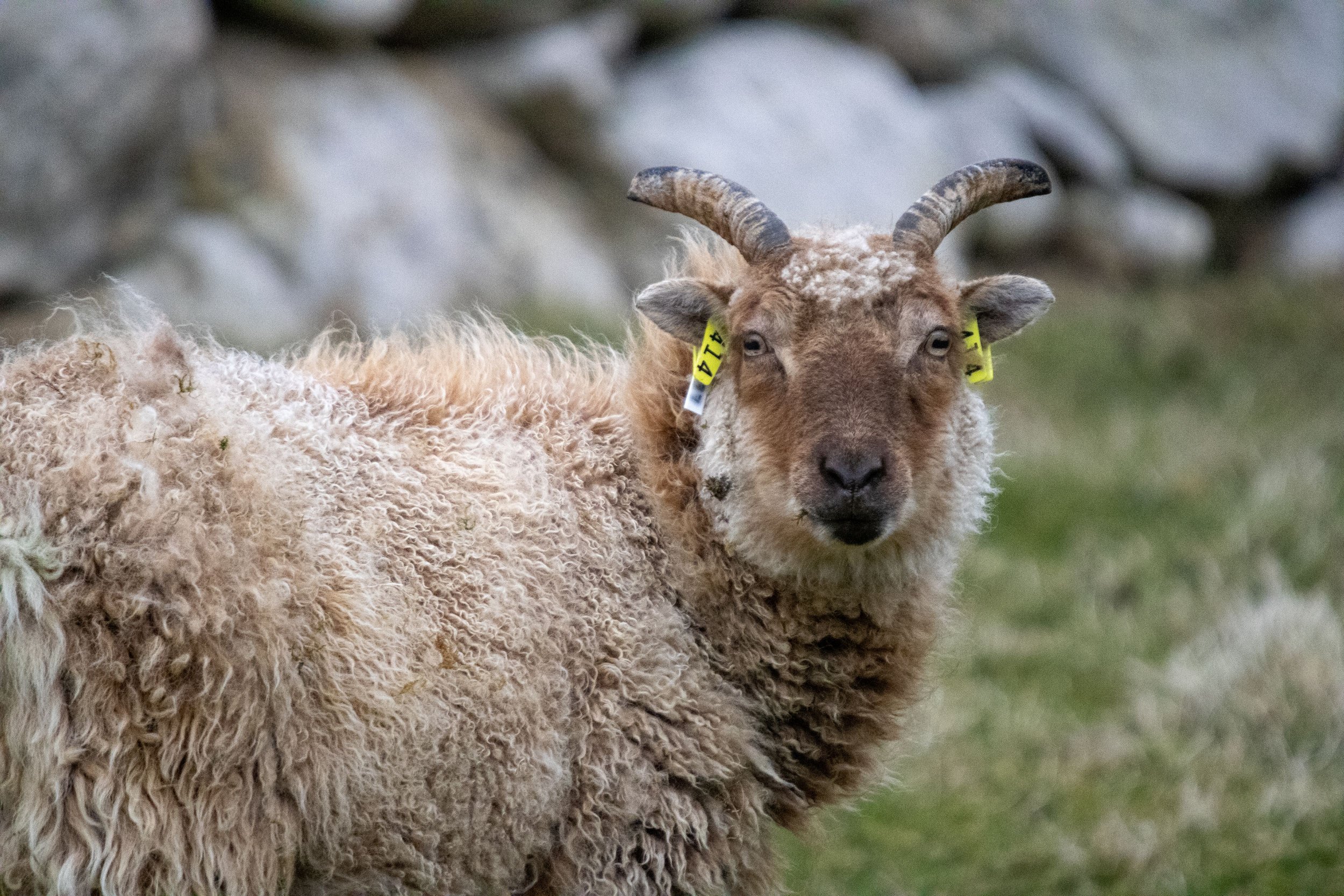
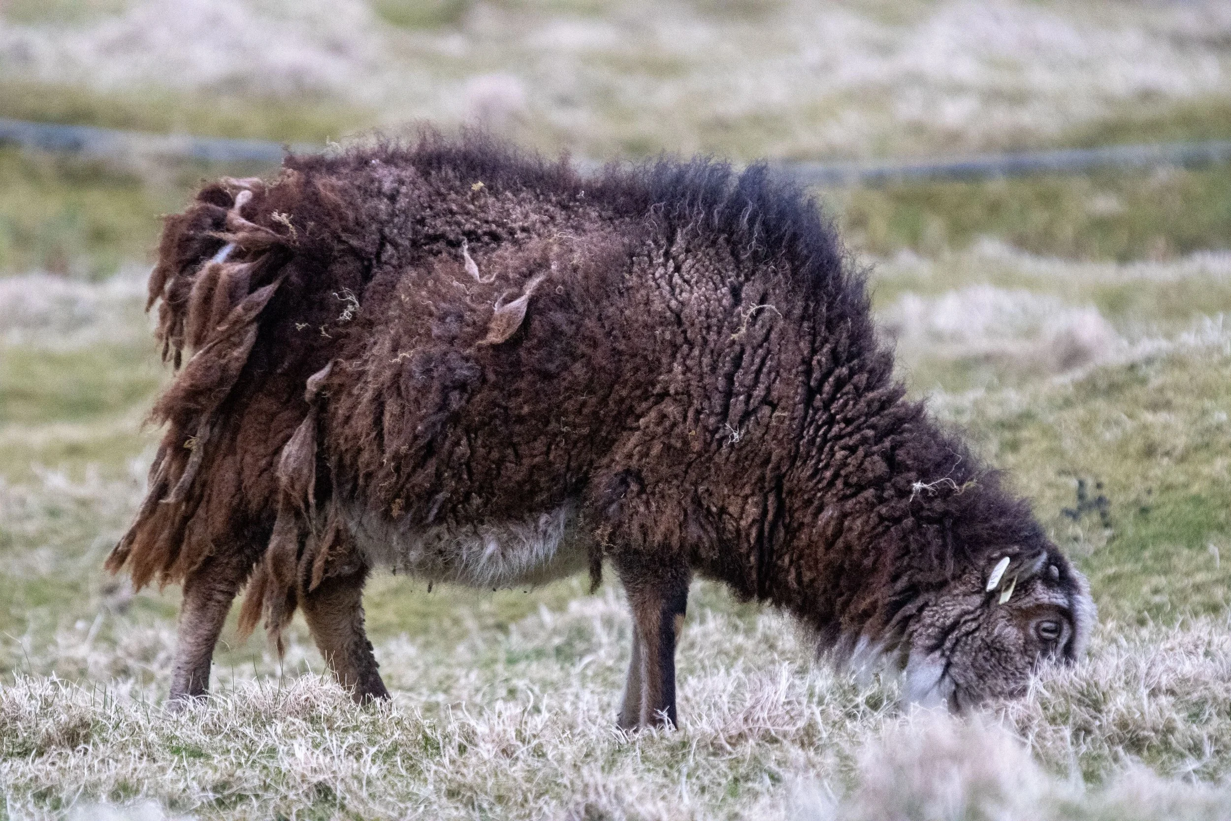
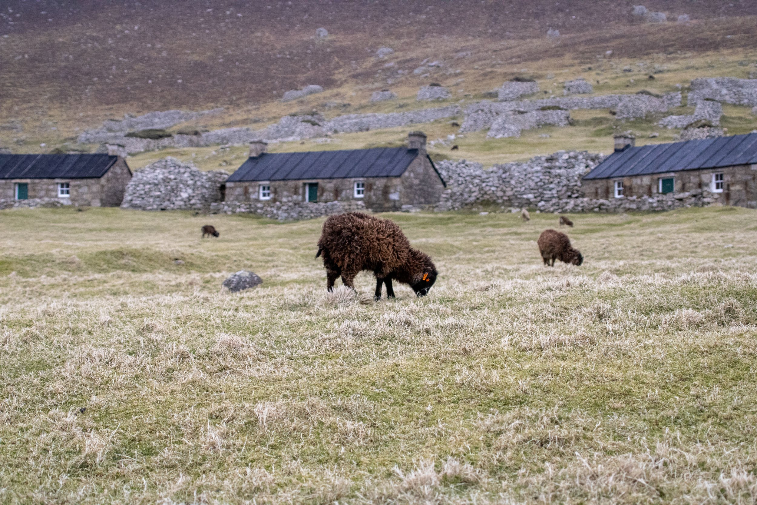
Shortly after the evacuation, a population of sheep from the nearby island of Soay was established on Hirta. They are an unmanaged, wild population. With no predators, the population has flourished, reaching about 2000 individuals last year. But they are not your average sheep! They stand about knee to mid-thigh height, and if they were not wary of humans, you’d think you could just scoop them up easily into your arms. There are brown and white varieties, some with small or no horns, and adult males with large, curly horns.
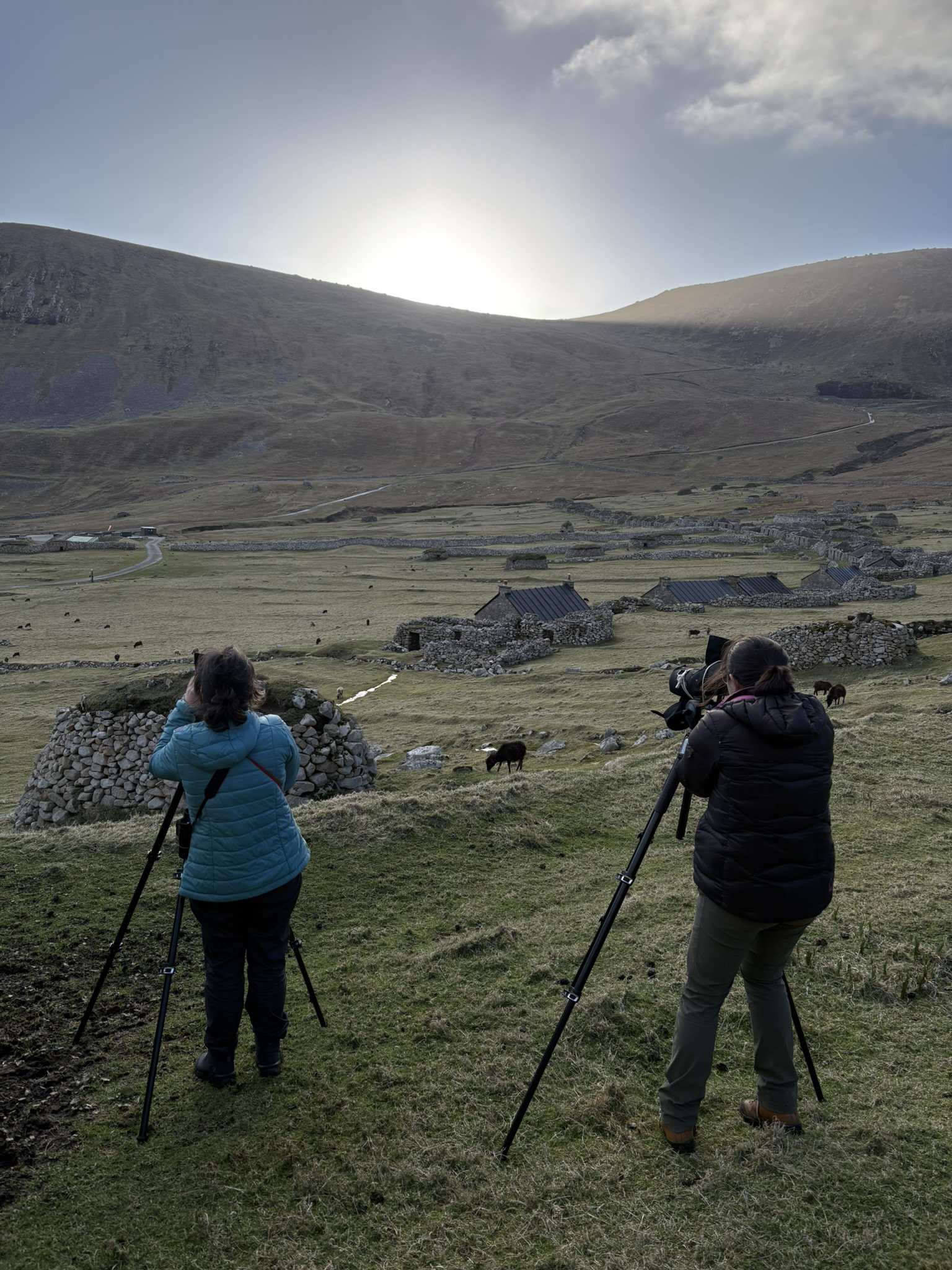
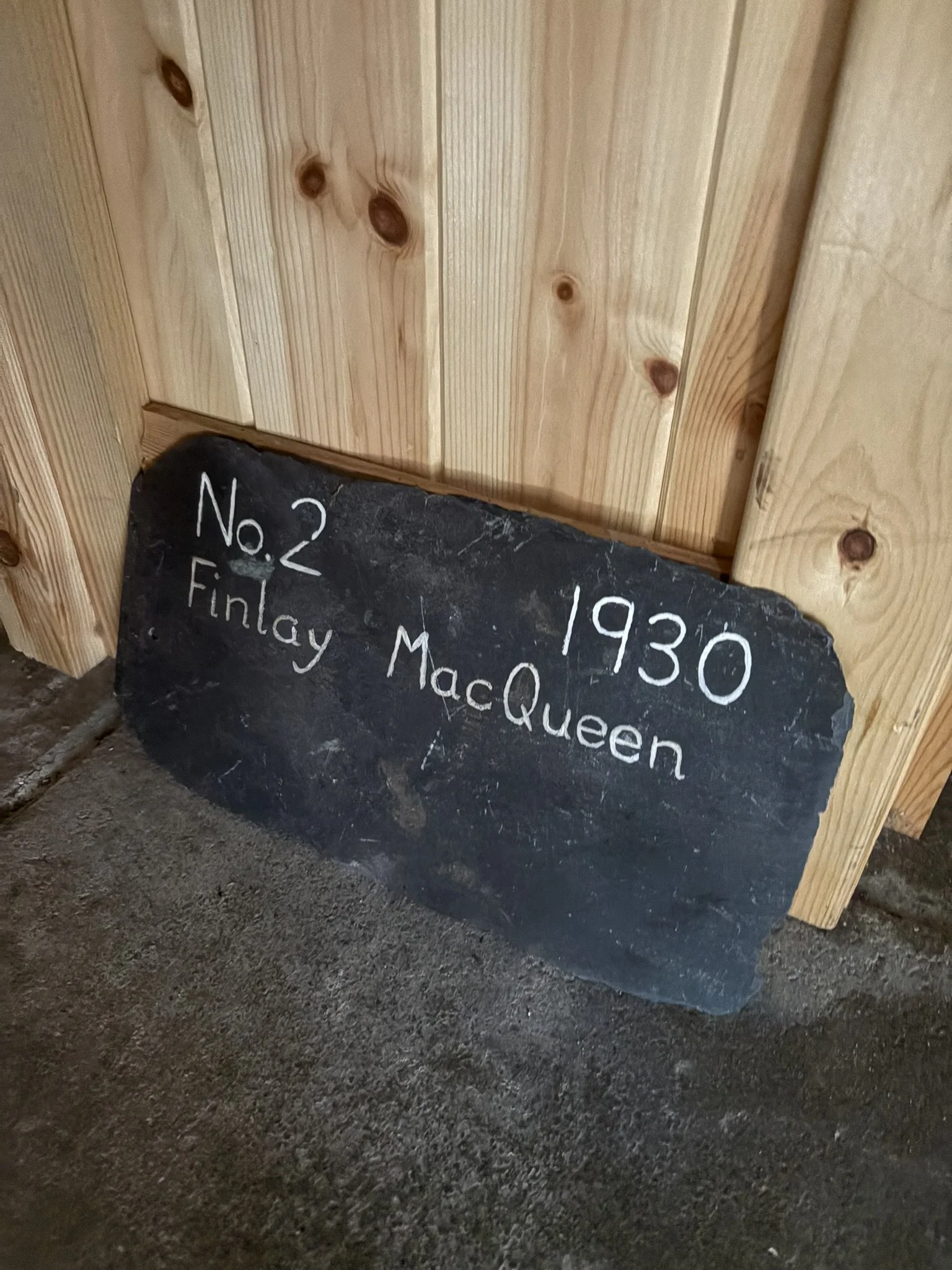
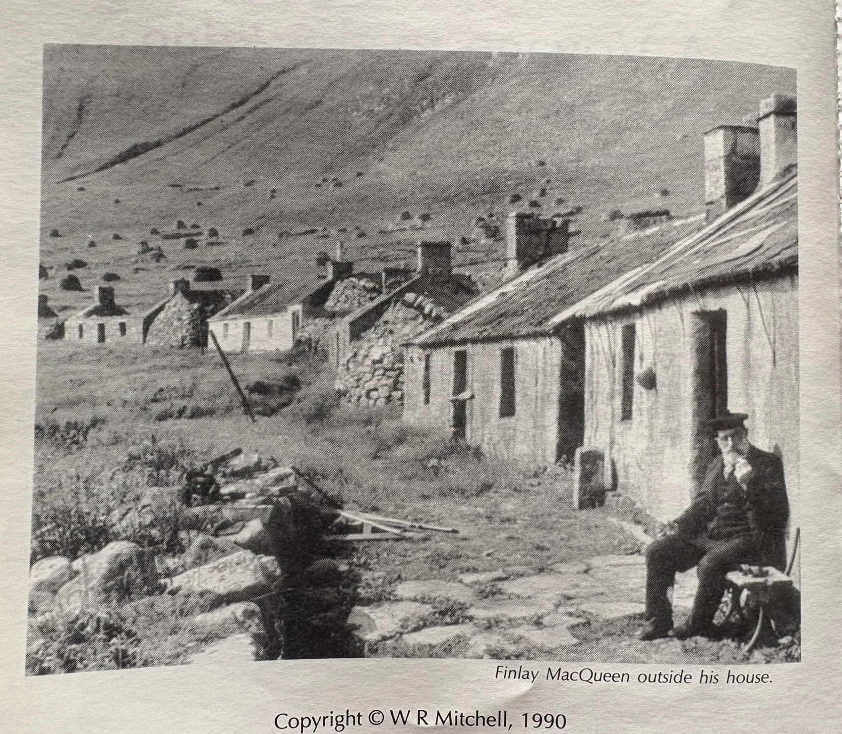
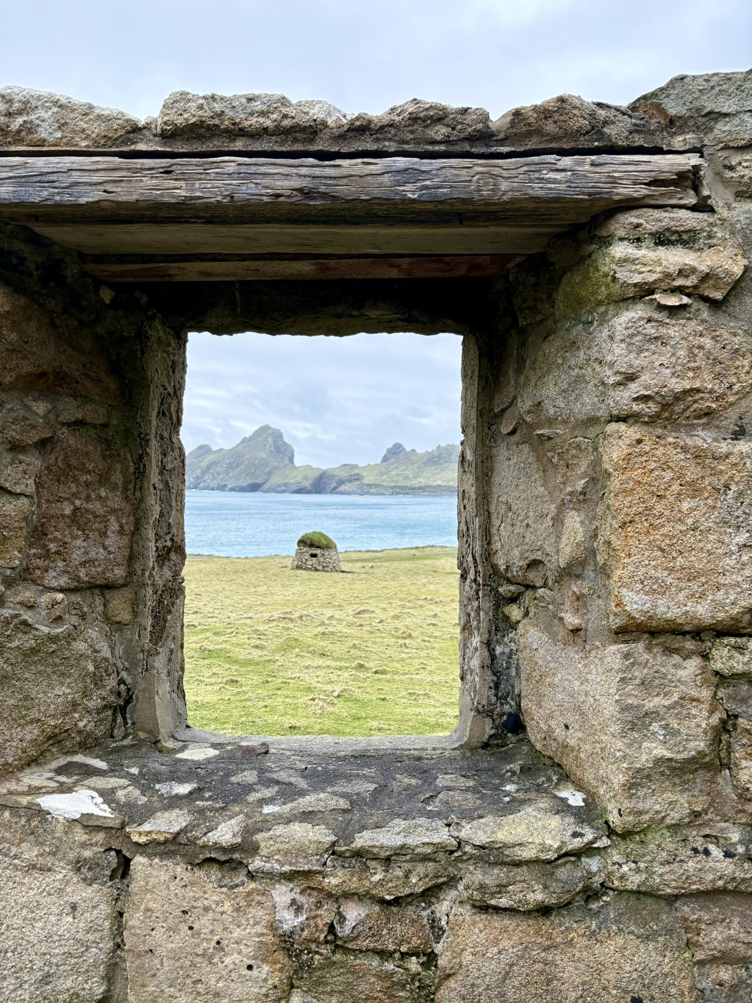
The ‘developed’ section of the island, where ‘the street’ is located, and where the heli lands and boats dock in the summer, is called Village Bay. Allow me to give you a tour: The Factor’s House is the first stop on the street. We use this house as an office workspace. It's the only place on the island we get wifi. (Although I did find a signal on my phone when I was high enough in the hills). About a minute walk down the street from there, you reach Cottage 1, which serves as a kitchen/dining space. I am staying in Cottage 2, which has been divided into two bedrooms. This house once belonged to a locally famous man named Finaly MacQueen (see the photo below of him outside his house). Cottage 3 has been turned into a museum of the island. Cottages 4 and 6 are also used for lodging. Cottage 5 is a workshop.
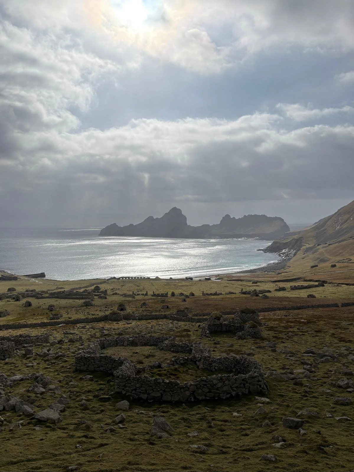
If you carry on down the street after Cottage 6, you come across a mix of derelict cottages and blackhouses. The cottages were constructed in 1860 from materials imported from the mainland. Prior to this, people lived in ‘blackhouses’, which were constructed in the 1830s. These housed people and livestock under a single roof during the winters.
South of the street, closer to the shore, you’ll find a shop called the Feather Store, which I imagine was named after what was historically the island’s greatest commodity: seabirds. It will open in a few weeks when the NTS rangers arrive on the island, and I should be able to buy postcards. The store had been hit, seemingly randomly, by shells from a German submarine during the First World War. Only one lamb was killed. A now rusted gun was erected in response, although never used. This part of the island is affectionately referred to as Gun Meadow. In Gun Meadow, you will also find a church with a schoolhouse attached. Today, there’s not much to be found in either of these buildings. There is a row of desks, photographs of barefoot school children, pews, and an altar. There is a spreadsheet too worn to read, that lists the reasons for pupils leaving the school. The words I could read most frequently were “died” or “left the island”, written in immaculate cursive.
The only permanent residents on the island now are employees contracted by the Ministry of Defence for some sort of missile tracking and testing. They have a base not far from the Factors House. It’s because of this military presence that we have the luxuries of running water and electricity. We commute together to St. Kilda on the heli, they tend to work in a ‘1 month on, 1 month off’ rotation, but otherwise don’t see much of one another.
After three long days of censusing sheep, we were given today off to relax and do laundry. In the sun, this truly feels like paradise. But the weather is changing, and we will be having some 70 mph winds along with rain, so we may be confined to our cottages for the next few days. Lucky for me, I live beside the museum! Last night, the wind blew so hard that I woke up several times to the latched door shaking loudly. Inside the stone cottage, I felt like an anchor in a rough sea, and imagined that everything else on the island would be completely blown away in the morning. Of course, when I awoke, everything was the same as always. Hundreds of sheep were grazing the meadows outside my cabin. Business as usual.
The calm before the storm
There’s so much more to learn about St. Kilda and its sheep than I’ve been able to write here, but I have just over 6 weeks to dig deeper into its history, catch newborn lambs, and meet all sorts of people who, for some reason, have also ended up on ‘the island at the edge of the world’.
Sheep grazing